The increasing number of technological advancements entering the market, including high-resolution topographic information and geolocation data, are helping to modernize the emergency management industry and changing the game in terms of how we support
decision-makers and communities impacted by hurricanes. Our involvement with the Federal Emergency Management Agency’s (FEMA) National Hurricane Program (NHP) spans two decades and incorporates technical expertise with these emerging technologies
to improve the hurricane evacuation studies (HES) used by federal, state, and local emergency managers.
Understanding the Importance of HES
HES are critical to a community’s understanding of how best to prepare for, mitigate, respond to, and recover from a hurricane. They provide critical information to decision-makers that can have life-saving impacts. These studies provide a myriad
of decision-making tools and datasets, including:
- Hazards analysis: How far inland will a storm surge reach and how deep is the water likely to be?
- Hurricane evacuation zones: Who needs to evacuate? Will the areas change based on the category of the storm? When should the public be notified to evacuate?
- Vulnerability analysis: What populations and infrastructure are at risk based on storm categories?
- Behavioral analysis: Who evacuates and where do they go?
- Shelter analysis: What is the capacity of identified shelters and how will the storm surge adversely affect them?
- Transportation analysis: How long will it take to evacuate the public? What roads will be impacted based on the storm and will traffic be impacted?
High-resolution Lidar Technologies Provide Data to Create Powerful Images
Updated high-resolution storm surge models from the National Hurricane Center’s (NHC) Sea, Lake, and Overland Surge from Hurricanes (SLOSH) coupled with high-resolution topographic information from lidar provide a more accurate depiction of the
threats faced by coastal communities from hurricane storm surge. With this detailed data, we are able to assess storm surge risk at the street level, quickly identifying critical facilities and infrastructure vulnerable to flooding. The image
below is a powerful demonstration used to inform the public about hurricane storm surge flooding. The World War II Memorial along the Savannah River riverfront is a well-known landmark familiar to many locals and visitors. The monument is 25 feet
wide and 19 feet tall and sits just feet from the Savannah River. The white lines show the maximum potential storm surge (MOM) depth for a Category 3 to 5 hurricane based upon the NHC’s SLOSH model.
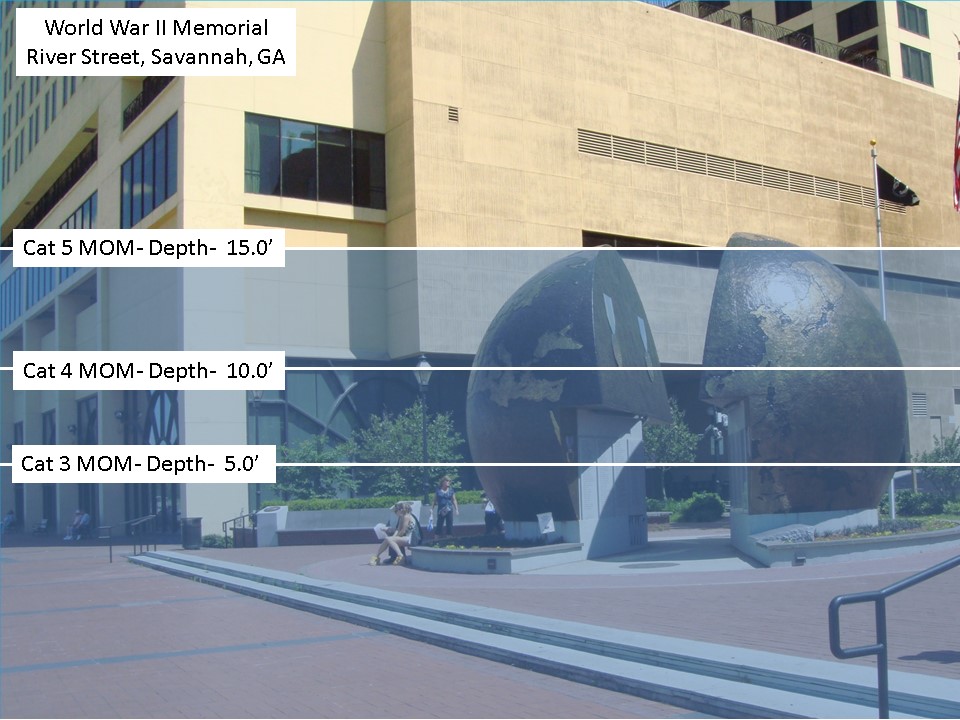
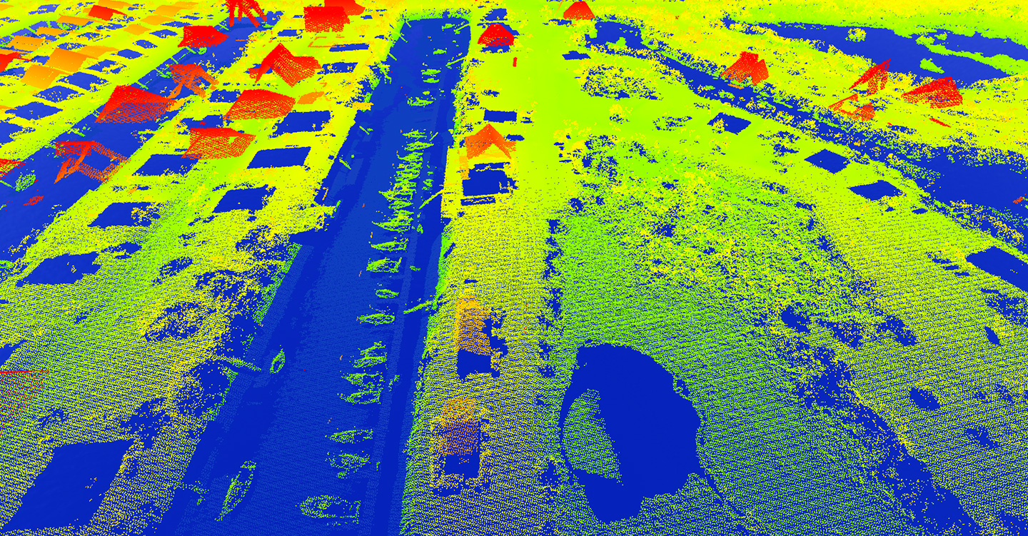
The image above is made possible by high-resolution topographic data available from lidar, allowing us to accurately determine the land elevation at the structure level. The image below shows the density of the lidar data, where there are approximately
1.5 elevation points per square foot. The data is dense enough that individual boats and piers along the waterfront are visible in the lidar points.
Emerging Geolocation Technologies Show Promise to Provide Real-Time Information
New emerging geolocation technologies will allow us to accurately identify and geolocate populations within the storm surge risk area, pre- and post-storm. These technologies and tools are designed to provide near real-time information. We are currently
investigating the use of anonymous cell phone data to help emergency managers pre-storm and post-storm to identify areas where populations may need assistance. This data will also allow us to determine, for future events, how people behave before,
during, and after storms, rather than relying on assumptions. This information is important to understand whether people heed evacuation warnings, when they realistically evacuate, where they go to, and other key information for protecting residents.
The technology is changing rapidly, and we are working to incorporate it where appropriate in order to improve the decision-making tools and data available, which play a critical role in the preparedness, response, and recovery phases of the disaster life cycle."
Kevin Slover
As landfalling hurricanes become more prevalent, this data will provide critical information necessary to protect those living in vulnerable areas along the coast and enhance the usefulness of hurricane evacuation studies.
To learn more about how technology impacts emergency management, check out this machine learning blog by Josh Novac and Colin Flynn, and this geospatial damage assessment blog by Ian Byers. This five-step reference for planning is a great resource from Jon Stewart.